


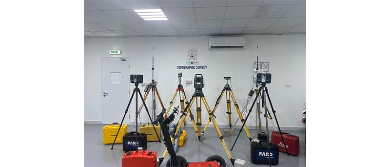

The Lonestar Survey Division provides high-precision surveying services that form the foundation of successful engineering and construction projects. Our experienced survey professionals transform complex site conditions into accurate, reliable spatial data that supports confident planning, design, and project execution.
Using advanced technologies and proven survey methodologies, we deliver cost-effective solutions tailored to the needs of developers, engineers, contractors, and infrastructure operators.
Our comprehensive surveying services include:
- Topographic Surveys
- Underground Utility Surveys and Mapping
- Geophysical Surveys
- 3D Laser Scanning and Reality Capture
- As-Built Data Capture and 3D Modelling
- Drone / UAV Aerial Mapping and Asset Inspection
- Bathymetric Surveys
All survey deliverables are provided in formats compatible with industry-standard design platforms such as AutoCAD, Civil 3D, and BIM software.
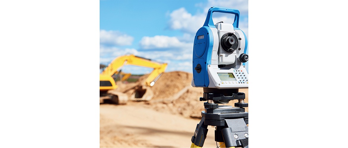
Topographic Survey
Topographic surveys are a critical first step in the planning and design of any construction or infrastructure project. These surveys capture detailed measurements of both natural and man-made features of a site, including ground elevations, contours, structures, utilities, and other surface features.
Using modern surveying equipment and established workflows, our team produces clear and accurate survey drawings that enable engineers and designers to make informed decisions.
Topographic surveys are commonly required for:
- Construction projects
- Land development planning
- Road and bridge design
- Utility infrastructure design
- Drainage and grading design
All survey results are delivered in accordance with applicable municipality and ADNOC procedures and provided in digital formats preferred by the client’s design team.
Underground Utility Survey & Utility Mapping
Underground Utility Surveys identify and map buried services such as pipelines, electrical cables, telecommunications lines, and drainage systems. Accurate knowledge of underground utilities is essential to ensure safe excavation, prevent damage to existing infrastructure, and support efficient project design.
As urban infrastructure continues to expand, reliable information about existing utilities becomes increasingly important. Incomplete or outdated records can lead to:
- Safety risks to workers and the public
- Damage to third-party assets
- Construction delays and design conflicts
- Unnecessary excavation and rework
Our utility mapping services combine multiple detection and verification techniques to ensure accurate results.
These include:
- Desktop utility record searches
- Site reconnaissance surveys
- Electromagnetic detection methods
- Ground Penetrating Radar (GPR) scanning
- Utility verification through trial pits or slit trench excavation
Electromagnetic locators and GPR equipment allow our team to detect and trace underground services such as cables, pipes, and other buried structures. In many cases, services can be detected at depths of up to 3–5 meters depending on site conditions.
Where necessary, trial pits are used to verify utility locations and confirm depths. All verified data is accurately recorded and compiled into detailed utility maps for future reference and project coordination.
3D Laser Scanning (Reality Capture) & As-Built 3D Modelling
3D Laser Scanning, also known as Reality Capture, is a modern surveying technique used to capture the precise geometry of buildings, industrial facilities, and infrastructure assets.
Using high-precision laser scanners, millions of measurement points are collected to create a detailed 3D point cloud representing the exact conditions of a site. This digital dataset is then processed and converted into accurate As-Built 3D models using advanced modelling platforms such as:
- Leica Cyclone
- Autodesk Revit
- AVEVA
Our specialized modelling team develops coordinated as-built models that engineers, designers, and contractors can use for design development, clash detection, renovation planning, and asset management.
Key Benefits
- Reduces the need for multiple site visits
- Provides accurate digital records of existing conditions
- Allows teams to visualize the site remotely
- Enables extraction of accurate 2D plans and elevations
- Fully compatible with AutoCAD, Civil 3D, and BIM platforms
- This end-to-end service improves project efficiency, reduces risk, and provides a reliable digital twin of your project environment.
Drone / UAV Aerial Mapping & Asset Inspection
Our drone surveying services provide fast and efficient aerial data collection for projects of any size. Using professional UAV systems combined with advanced photogrammetry workflows, we generate high-resolution aerial datasets with centimetre-level accuracy.
Deliverables may include:
- Geo-referenced orthophotos
- Ortho mosaic maps
- 3D terrain models
- Digital surface models
- Dense point clouds
Drone inspections also provide a safe and efficient method for inspecting structures such as towers, rooftops, storage tanks, and industrial facilities without the need for scaffolding or operational shutdowns.
The resulting geo-referenced imagery and inspection reports help identify defects early and allow maintenance teams to plan repairs more effectively.
Bathymetric Survey
Bathymetric surveys measure and map underwater terrain to provide accurate information about seabed conditions and water depths. Using advanced sonar and positioning systems, we generate detailed digital models of underwater environments.
These surveys are essential for projects involving:
- Marine construction
- Port and harbour development
- Dredging operations
- Coastal infrastructure projects
- Environmental monitoring
Our bathymetric surveys help identify underwater features such as shallow areas, sediment accumulation, and scour around structures. This data provides engineers and planners with reliable information needed for safe navigation, infrastructure design, and environmental assessment.
GIS (Geographical Information System)
Geospatial information is a key driver for smarter planning and more effective development across multiple sectors. Our GIS solutions provide enhanced visibility, reduced risk, and improved decision-making for your projects. Core Capabilities of Our GIS Unit
- Data Capture & Management
Accurate collection, integration, and management of spatial and survey data. - Data Analysis & Modelling
Advanced spatial analysis to support engineering and environmental assessments. - Mapping & Visualisation
High-quality maps and 3D terrain models for clear project understanding. - Collaboration & Data Sharing
Seamless data access across project teams and stakeholders. - Decision Support & Problem Solving
Data-driven insights to optimise planning, design, and execution.
Our GIS unit currently integrates geotechnical investigations and topographical survey data into a single intelligent mapping environment. We combine: Borehole data, laboratory testing results (CPTs and trial pits), geological mapping, high-resolution terrain and contour models, this integrated approach provides designers and decision-makers with a clear understanding of ground conditions and site constraints.
Project Benefits - Improved route selection and site planning, optimised foundation design, reduced project risk, enhanced coordination across disciplines, faster and more informed decision-making
Why Choose Lonestar Survey Division
- Experienced and highly skilled survey professionals
- Advanced surveying technology and equipment
- Compliance with municipality and ADNOC standards
- Accurate digital deliverables compatible with engineering software
- Efficient data processing and quick turnaround times
- Our commitment to accuracy, reliability, and innovation ensures that clients receive the high-quality survey data required to deliver successful projects.